3D Mapping for Land Sales in Kenya: The Future of Real Estate Marketing
The Kenyan real estate industry is evolving rapidly. For years, land-selling companies have relied on roadside banners, static photos, PDF brochures, drone footage, and physical site visits to market plots. While these methods still work, buyers today expect a more interactive and transparent experience before making investment decisions.
This is where 3D mapping technology is changing the game.
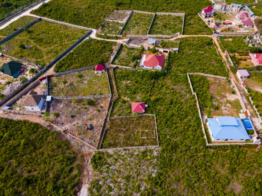
Imagine a potential buyer in Nairobi, Mombasa, Kisumu, Eldoret, or even abroad being able to virtually explore a piece of land from their phone or laptop, rotating the terrain, checking plot layouts, viewing roads, nearby amenities, elevations, landmarks, and even future developments, without physically visiting the site.
That is the promise of 3D mapping for land sales.
For Kenyan land-selling companies, this innovation could become one of the most powerful digital marketing tools in the real estate industry.
What Are 3D Maps?
A 3D map is a digital representation of a physical location that shows:
- Terrain and elevation
- Roads and access routes
- Plot boundaries
- Buildings and landmarks
- Vegetation and environment
- Spatial relationships between objects
Unlike ordinary 2D maps, 3D maps allow users to view land from multiple angles and perspectives, giving a more realistic understanding of the property.
Think of it as combining:
- Satellite maps
- Interactive virtual tours
- Land subdivision plans
- Terrain visualization
- Real estate presentation tools
into one immersive experience.
What Is 3D Mapping?
3D mapping is the process of creating interactive digital models of real-world locations.
This can involve:
- Satellite imagery
- GIS (Geographical Information Systems)
- GPS coordinates
- Survey data
- Terrain modeling
- Architectural visualization
- Drone data (optional)
- Manual digital modeling
The final output becomes an interactive map that users can:
- Zoom into
- Rotate
- Explore
- Share online
- Embed on websites
- Open on mobile devices
Modern 3D mapping platforms can even allow:
- Plot selection
- Distance measurements
- Navigation
- Live location integration
- Future development simulation
Why 3D Mapping Matters in Kenyan Land Sales
Land buyers in Kenya often face major challenges:
1. Difficulty Understanding Plot Locations
Many buyers only see:
- A beacon number
- A sketch map
- A few photos
- A sales brochure
This creates uncertainty.
A 3D map solves this by visually showing:
- Exact plot positioning
- Neighboring plots
- Roads
- Terrain
- Rivers
- Schools
- Trading centers
- Utilities nearby
2. Long-Distance Buyers
Many Kenyans buy land while:
- Living abroad
- Working in different counties
- Living in urban centers far from the plots
Traveling to inspect land can be expensive and time-consuming.
A shareable 3D mapping platform allows buyers to virtually inspect properties remotely.
This is especially valuable for:
- Diaspora investors
- Busy professionals
- SACCO investors
- Chama groups
- Corporate buyers
3. Trust and Transparency Issues
The land sector in Kenya has historically suffered from:
- Misrepresentation
- Fake locations
- Double allocation
- Exaggerated marketing claims
Interactive 3D maps improve transparency by visually presenting:
- Actual access roads
- Terrain condition
- Plot arrangement
- Distance from infrastructure
- Surrounding developments
This builds buyer confidence.
How a 3D Mapping Platform Works
A modern land-sales 3D mapping platform can include:
Interactive Plot Layouts
Users can:
- Click individual plots
- View plot numbers
- Check availability
- See pricing
- View dimensions
Terrain Visualization
Buyers can understand:
- Flat land
- Sloped areas
- Valleys
- Hilltops
- Drainage patterns
This helps buyers evaluate suitability for:
- Residential construction
- Farming
- Commercial projects
- Vacation homes
Virtual Site Navigation
Users can digitally “move around” the property area similar to a game environment or virtual tour.
Landmark Highlighting
The platform can show nearby:
- Schools
- Highways
- Hospitals
- Shopping centers
- Rivers
- Electricity lines
- Water connections
- Tourist attractions
Website Integration
The mapping system can:
- Operate as a standalone platform
- Be embedded into real estate websites
- Be shared via links
- Be integrated into social media campaigns
This means land companies can market directly through:
- Websites
- TikTok
- Email campaigns
Why This Could Replace Traditional Drone Marketing
Drone footage has become common in Kenyan real estate marketing. While drones provide attractive visuals, they still have limitations.
Drone Videos Are Passive
Buyers only watch what the videographer recorded.3D maps are interactive.
Users control:
- Viewing angles
- Zoom level
- Navigation
- Plot selection
Drone Shoots Must Be Repeated
Every new project may require:
- Travel
- Pilots
- Equipment
- Editing
A 3D mapping system can be updated digitally without repeated field shoots.
Drone Videos Are Harder to Explore
In a video, a buyer may miss:
- Access roads
- Exact boundaries
- Terrain changes
- Neighboring developments
3D mapping allows deeper exploration.
Benefits for Land Selling Companies
1. Stronger Marketing Advantage
Companies using 3D maps instantly appear:
- Modern
- Professional
- Transparent
- Tech-driven
This can significantly improve brand perception.
2. Higher Buyer Engagement
Interactive experiences keep users engaged longer than ordinary photos or PDFs.
The longer a potential buyer interacts with a property presentation, the higher the likelihood of conversion.
3. Faster Decision-Making
When buyers clearly understand the property:
- Fewer physical visits are required
- Fewer clarifications are needed
- Sales cycles shorten
4. Better Diaspora Sales
Diaspora buyers are among the most valuable real estate customers in Kenya.3D mapping helps them confidently evaluate land remotely.
5. Reduced Marketing Costs Over Time
Although initial setup may require investment, long-term costs can reduce because companies spend less on:
- Repeated drone shoots
- Physical site tours
- Printed brochures
- Repetitive customer explanations
6. Easier Social Media Marketing
3D mapping platforms create highly shareable content.
A company can simply send:
- A link
- QR code
- Embedded preview
instead of dozens of photos and videos.
Benefits for Buyers
Better Understanding of the Property
Buyers can see:
- Terrain
- Access
- Plot arrangement
- Surrounding environment
before purchasing.
Saves Time and Travel Costs
Potential investors can narrow down options before visiting physically.
Improved Investment Confidence
Transparent visualization reduces uncertainty.
Easier Comparison Between Projects
Buyers can compare:
- Locations
- Layouts
- Terrain
- Amenities
more effectively.
Potential Features of Future Kenyan 3D Land Platforms
As the technology grows, future systems may include:
- Real-time plot availability
- Online booking
- Reservation systems
- Payment integration
- AI-powered recommendations
- Virtual reality (VR) tours
- Augmented reality (AR) viewing
- Smart city planning integration
- Infrastructure development simulation
Some platforms may eventually allow buyers to:
- Place virtual houses on plots
- Simulate fencing
- Estimate construction layouts
- View future road networks
Industries Beyond Land Sales
3D mapping technology can also be used in:
- Property development
- Tourism
- Agriculture
- Smart cities
- Infrastructure planning
- Wildlife conservancies
- Industrial parks
- University campuses
- Event planning
- Security operations
This means the technology has massive growth potential beyond real estate.
Challenges the Industry Must Address
Like any innovation, adoption may face challenges:
Internet Accessibility
Some users may have limited internet access for high-quality interactive maps.
Initial Development Costs
Creating high-quality 3D maps requires:
- Technical expertise
- GIS knowledge
- Software infrastructure
Data Accuracy
The system must ensure:
- Correct plot boundaries
- Updated availability
- Accurate terrain representation
User Education
Some buyers may initially be unfamiliar with interactive map systems.
However, smartphone adoption and digital literacy in Kenya continue to grow rapidly.
The Future of Real Estate Marketing in Kenya
The Kenyan property market is becoming increasingly digital.
Buyers now expect:
- Transparency
- Convenience
- Interactive experiences
- Faster communication
Companies that embrace digital tools early often gain major competitive advantages.
Just as websites, social media, and drone videos transformed real estate marketing over the past decade, 3D mapping may become the next major leap.
Forward-thinking land-selling companies that adopt this technology early could:
- Build stronger customer trust
- Reach wider markets
- Increase conversion rates
- Modernize their operations
- Stand out in a crowded industry
Conclusion
3D mapping is more than just a visual tool — it is a new way of experiencing and understanding land.
For land-selling companies in Kenya, it offers:
- Better marketing
- Greater transparency
- Improved customer engagement
- Wider market reach
- Reduced long-term marketing costs
For buyers, it offers:
- Clarity
- Convenience
- Confidence
- Better decision-making
As Kenya’s digital economy grows, technologies like interactive 3D mapping could redefine how land is marketed, viewed, and sold.
The future of real estate marketing may no longer be static photos and brochures.
It may be fully interactive, immersive, and digitally accessible from anywhere in the world