Why Kenya's Best Land Listings Are Still Selling Buyers Short And Here’s How We Change It
You've seen it a hundred times. A land listing goes up. Sharp satellite imagery, a price, a plot size, maybe a few photos. The buyer reads it, gets interested, then asks the question every land seller dreads:
"Where exactly is it? And how do I get there?"
Then begins the back and forth. WhatsApp voice notes describing turns. Screenshots of Google Maps with arrows drawn on them. Phone calls that end with "just come, I'll show you." And somewhere in that friction, serious buyers lose confidence and move on.
This is the gap that has existed in Kenya's property market for years. And it has finally been solved.
The question every land seller dreads
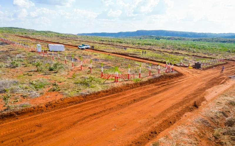
Most land listings in Kenya, even the well-presented ones, rely on satellite imagery from providers like Airbus or Maxar. This imagery is genuinely impressive. High resolution, scrollable, zoomable and you can see the plot from above with remarkable clarity.
But satellite imagery answers only the question: where is the land?
It does not answer: what is it like to get there? What does the terrain feel like? What surrounds the plot? Is the access road tarmac or murram? What landmarks will I pass?
These are the questions that drive the actual decision. And for land listings specifically, where buyers are often evaluating remotely, from Nairobi, from the diaspora, from abroad, the inability to answer them is a real and costly problem.
A buyer who cannot picture the journey to a plot will not commit to visiting. And a buyer who does not visit does not buy.
Same satellite But Told Differently
What has been built is not a replacement for satellite imagery. It is the layer above it.
Interactive 3D property maps that give a buyer a complete, navigable experience of a property before they ever set foot on it. From the moment they open the link, they are taken on a guided journey, flying in from the main highway, following the access road through key landmarks, reading the terrain and elevation, and landing on the plot itself.
Everything they need to make a serious decision. In one link. Before the first site visit.
The difference is not technical. It is experiential. Satellite imagery shows a buyer a picture. These maps put a buyer in the property.
See it yourself
The screenshot below is a live map, not a render, not a concept, it’s a real property, a real route, a real buyer experience.
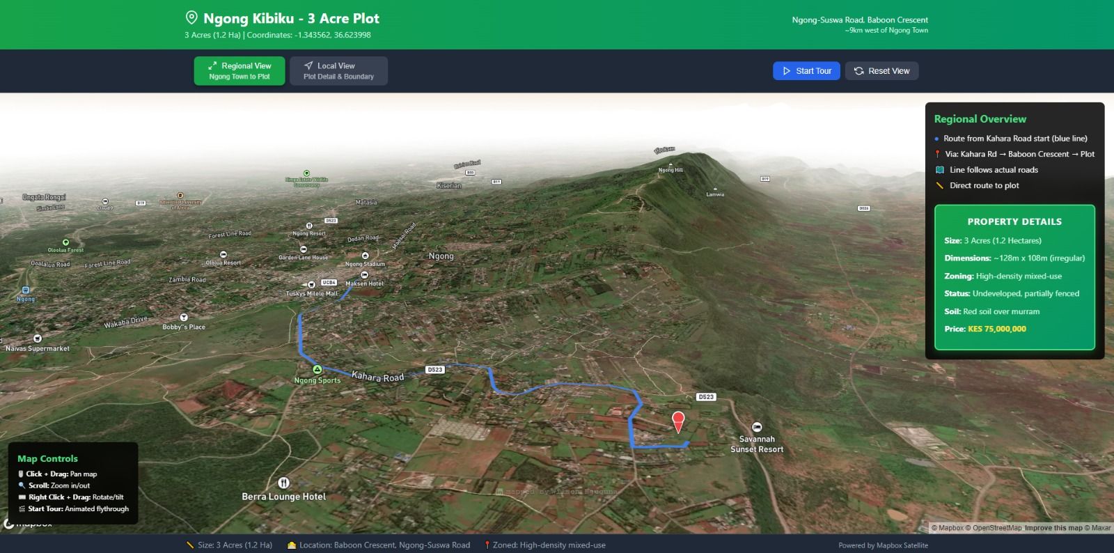
What you are looking at: a 3-acre plot near Ngong Town. The blue line is the actual access route from Kahara Road to the plot. The property details panel on the right, size, zoning, soil type, price, is collapsible and embedded in the map itself. The Ngong Hills sit in the background, giving a buyer an immediate sense of the terrain and surroundings that no flat satellite image could ever convey.
That is one link. Shareable on WhatsApp, embeddable on a website, openable on any phone without having to download an app.
Three properties are currently live and actively for sale using this technology, ranging from affordable residential plots to premium acreage and large-scale commercial land.
If you are a serious buyer or an agent with a client who may be interested, reach out directly and we will share access to the relevant map.
This changes the game for
Property agents handling land listings, especially in peri-urban and rural areas where access and terrain are part of the value proposition. If you have ever spent 30 minutes on a call explaining how to find a plot, this is the tool that replaces that conversation entirely.
Land selling companies and developers with multiple plots across a project. An interactive map of an entire scheme — with individual plot availability, pricing, and a guided tour — changes how buyers engage with your inventory.
SACCOs and Chamas marketing land to members who may be spread across the country or abroad. A shareable link that gives every member the same clear picture is more powerful than any brochure.
Diaspora investors evaluating Kenyan land from outside the country. The barrier between interest and commitment shrinks dramatically when a buyer can navigate a property from London or Toronto as clearly as someone sitting in Nairobi.
Individual sellers who want their property to stand out in a crowded market. In a sea of satellite thumbnails and plot coordinates, a 3D interactive map is the listing that gets shared.
Very few are doing this yet
Here is the honest reality, very few agents and sellers in Kenya are using this yet. The technology exists, the infrastructure is in place the maps are live, but the market has not caught on.
That means right now, the agents and companies that move first will own the positioning. A buyer who has explored a property through an interactive 3D map before visiting will remember the agent who gave them that experience. A seller whose listing stands apart from every other plot on the market will close faster.
This is not about technology for its own sake. It is about what the technology does, it essentially builds the confidence a buyer needs to act.
One link on Any device Before the visit
Each map is built specifically for the property. Coordinates, access routes, landmarks, property details, pricing, all embedded in a single shareable link that works on any device, desktop or mobile.
The map can be shared via WhatsApp, embedded in a website listing, sent in an email, or included in a presentation. No app to download. No account to create. A buyer opens the link and they are in the property.
Updates to pricing, availability, or property details are made in minutes and go live immediately.
The listings that win from here
Kenya's property market is growing fast. Buyers are more informed, more discerning, and increasingly making decisions remotely. The listings that win will be the ones that meet buyers where they are, with clarity, transparency, and an experience that makes the decision easy.
The question is no longer whether interactive 3D maps will become standard for land listings in Kenya. It is who gets there first.
For enquiries about 3D property maps for your listings,
Contact: +254 714 752 421
WhatsApp: +254 731 268 385