Why Drone Videos Alone Are No Longer Enough in Real Estate Marketing
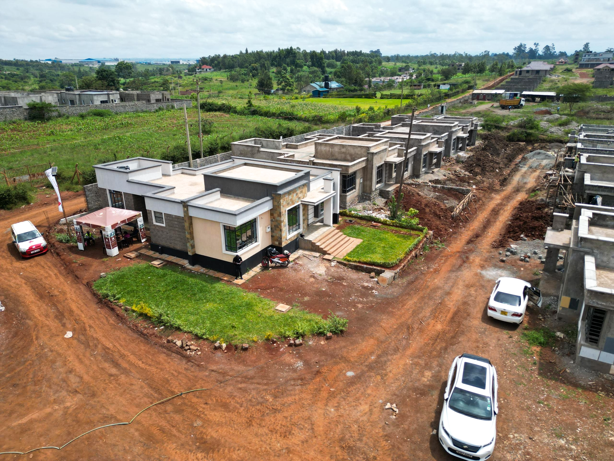
Over the past few years, drone videos have transformed real estate marketing in Kenya. Land-selling companies, property developers, and real estate agents quickly adopted drone technology because it offered something traditional photography could not, aerial visibility.
Suddenly, buyers could see:
- Entire plot layouts
- Access roads
- Surrounding developments
- Terrain
- Nearby infrastructure
Drone marketing brought a fresh and professional feel to property advertising.
But as the market becomes more competitive and buyers become more digitally sophisticated, drone videos alone are no longer enough.
Today’s buyers want more than beautiful visuals.
They want:
- Interaction
- Transparency
- Control
- Detailed exploration
- Real-time information
- Remote convenience
This is why the real estate industry is now moving toward interactive technologies such as 3D mapping platforms.
Drone footage still has value, but it is increasingly becoming only one piece of a much larger digital marketing strategy.
The Rise of Drone Marketing in Kenya
Drone technology became popular in Kenyan real estate because it solved several major problems.
Instead of relying only on:
- Static photos
- Sketch maps
- Printed brochures
companies could now showcase:
- Large land projects
- Estate developments
- Scenic landscapes
- Road networks
- Neighborhood growth
Drone shots created excitement and gave buyers a broader understanding of property locations.
For many land-selling companies, drone videos immediately improved:
- Brand image
- Buyer interest
- Social media engagement
- Online marketing quality
However, the market has evolved.
What impressed buyers a few years ago is now becoming standard.
The Main Problem with Drone Videos
Drone videos are impressive, but they are still passive.
The buyer simply watches what the videographer chooses to show.
This creates several limitations.
1. Buyers Cannot Interact with Drone Videos
A drone video follows a fixed path.
The viewer cannot:
- Rotate the environment
- Zoom into specific plots
- Click on plot numbers
- Explore roads independently
- Inspect terrain from different angles
- Check exact positioning
Once the video ends, the exploration stops.
Modern buyers increasingly prefer interactive experiences where they control the viewing process themselves.
2. Drone Videos Do Not Clearly Show Plot Details
Many land buyers want very specific information such as:
- Which exact plot is available?
- Where are the access roads?
- Which plot is closest to the highway?
- Which side has electricity?
- Which plots are corner plots?
- What amenities are nearby?
Drone videos often provide beautiful cinematic views but limited detailed navigation.
This can leave buyers confused after watching.
3. Drone Marketing Still Requires Physical Clarification
After watching a drone video, buyers often still ask:
- “Can you show me the exact plot?”
- “How far is the tarmac?”
- “Which side is the school?”
- “Where does the road pass?”
- “Which plots remain unsold?”
Sales teams end up spending significant time explaining details manually through:
- Phone calls
- Additional photos
- Sketch maps
- Physical visits
Interactive 3D mapping reduces much of this back-and-forth communication.
4. Drone Videos Become Outdated Quickly
Real estate projects change constantly.
Things that may change include:
- Plot availability
- Road expansion
- Infrastructure development
- New buildings
- Utility installations
- Project phases
A drone video captured months ago may no longer accurately represent the project.
Updating drone footage requires:
- Scheduling flights
- Travel
- Equipment
- Editing
- Additional production costs
By contrast, digital 3D maps can be updated more efficiently.
5. Drone Videos Are Harder to Use for Remote Buyers
Diaspora investors and long-distance buyers are among the fastest-growing customer groups in Kenyan real estate.
These buyers often want deeper understanding before making decisions remotely.
A drone video may look attractive, but buyers still struggle to:
- Understand exact plot locations
- Compare plots
- Evaluate terrain
- Measure accessibility
Interactive platforms allow remote buyers to explore properties much more confidently.
6. Drone Footage Rarely Offers Real-Time Information
Most drone videos are promotional rather than informational.
They usually do not display:
- Live plot availability
- Pricing updates
- Reservation status
- Interactive dimensions
- Real-time project updates
Modern digital buyers increasingly expect dynamic information rather than static marketing.
7. Drone Videos Do Not Fully Build Transparency
In Kenya’s land sector, trust is extremely important.
Some buyers are skeptical because of:
- Misleading marketing
- Hidden terrain problems
- Exaggerated claims
- Inaccurate location descriptions
A polished drone video may sometimes appear too promotional.
Interactive 3D mapping platforms improve transparency by allowing buyers to independently explore:
- Access roads
- Terrain
- Plot arrangement
- Neighboring developments
- Distances and positioning
This creates greater buyer confidence.
The Shift Toward Interactive Real Estate Marketing
The global real estate industry is shifting toward immersive digital experiences.
Buyers increasingly expect:
- Virtual property exploration
- Mobile accessibility
- Interactive navigation
- Digital convenience
- Real-time updates
This is why technologies such as:
- 3D mapping
- GIS visualization
- Virtual tours
- Interactive property portals
- Augmented reality
are becoming more important.
The future is not just about showing land.
It is about allowing buyers to experience it digitally.
What Makes 3D Mapping More Powerful?
Unlike ordinary drone videos, interactive 3D mapping platforms allow users to:
Explore Freely
Users can:
- Zoom in
- Rotate views
- Navigate independently
- Inspect different sections
View Exact Plot Details
Buyers can click plots to see:
- Plot numbers
- Availability
- Size
- Pricing
- Positioning
Understand Terrain Better
3D terrain visualization helps users understand:
- Slopes
- Elevation
- Drainage
- Hilltops
- Flat areas
This is especially important for construction planning.
Access Maps on Mobile Devices
Buyers can explore projects from:
- Smartphones
- Tablets
- Laptops
without specialized software.
Share Easily
Interactive maps can be:
- Shared via WhatsApp
- Embedded into websites
- Used in social media campaigns
- Sent through email links
This improves digital marketing efficiency.
Drone Videos Are Still Valuable, But They Are No Longer Enough
This does not mean drone technology is obsolete.
Drone footage still plays an important role in:
- Visual storytelling
- Social media marketing
- Promotional campaigns
- Project launches
- Scenic showcasing
However, drone videos now work best when combined with:
- Interactive maps
- Digital plot systems
- Website integration
- Real-time property information
In other words:
Drone videos attract attention.
Interactive platforms sustain engagement and drive decision-making.
What This Means for Kenyan Land Companies
Land-selling companies that continue relying only on:
- Brochures
- Static photos
- Sketch maps
- Drone videos
may eventually struggle to compete with more digitally advanced firms.
Modern buyers increasingly prefer companies that provide:
- Better transparency
- Interactive experiences
- Convenient exploration
- Digital accessibility
Adopting technologies such as 3D mapping can help companies:
- Modernize branding
- Improve customer trust
- Increase engagement
- Reach diaspora markets
- Reduce repetitive explanations
- Improve conversion rates
The Future of Real Estate Marketing in Kenya
Kenya’s property industry is entering a more digital era.
Just as:
- Websites replaced newspaper-only advertising
- Social media changed customer outreach
- Drone videos modernized property showcasing
interactive 3D mapping may become the next major evolution.
The companies that adopt these technologies early are likely to stand out as:
- Innovative
- Transparent
- Customer-focused
- Future-ready
Conclusion
Drone videos revolutionized real estate marketing in Kenya, but buyer expectations have continued to evolve.
Today’s buyers want more than aerial visuals.
They want:
- Interaction
- Exploration
- Transparency
- Real-time information
- Remote accessibility
This is why drone footage alone is no longer enough.
The future of land marketing is increasingly interactive, data-driven, and digitally immersive.
For forward-thinking real estate companies, combining drone visuals with interactive 3D mapping platforms could become one of the most powerful ways to market land in the modern era.